Wednesday, 26 January 2022

Barbuda to St Martin

Hi everyone,

On Monday we departed Barbuda for an 80nm overnight sail to French St Martin.  The weather was perfect for a chilled-out downwind sail - 10-15 knots from the E.

Approaching St Martin

We spend most of the passage sailing under single-reefed main and double-furled yankee.  The WindPilot took care of the steering.  We saw a number of vessels over the shallow banks as we approached St Barts.  Several had no AIS which I assume were fishing vessels.  Others were yachts and cruise liners.

As the tracks below show, we gybed our way downwind in our usual manner, riding a shift from SE to NE which then settled in the E.

Track

Arrival Detail

Graphs

Here are the vital stats for the passage…

    • Distances/Speeds
        • Route Distance = 81nm
        • Logged Distance = 95nm
        • GPS Distance = 93nm
        • Duration = 19h
        • Average boat speed = 5.0 kt
        • Average speed over ground = 4.9 kt
        • Minimum boat speed = 3,5 kt
        • Maximum boat speed = 5.8 kt
    • Weather
        • Minimum wind speed = 4 kt
        • Average wind speed = 15 kt
        • Maximum wind speed = gusts to 19 kt
        • Apparent wind angle range = 120 to 160
        • Seas up to 1m
        • Swell up to 2m
        • Few small cumulus clouds, half moon
    • Engine
        • Total = 1.5 hours, mostly at start as we weaved out through the reefs & bombies

St Martin from the Anguilla Channel

Dinghying towards the passage into the lagoon

In the passage with Ile Marine on RHS

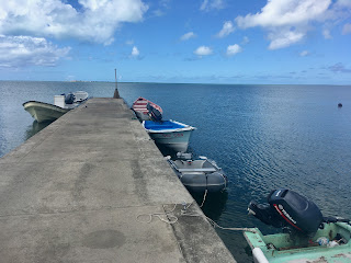
We arrived at 0930 yesterday.  A couple of hours later we dinghied in to Ile Marine to clear in.  Ile Marine has its own dinghy dock as shown in the photo above.  The clearing in computer is just inside the main entrance.  Fill in one electronic form and present your boat registration and passports for a store staff member to check and you're in.  Too easy!

Yesterday afternoon was spent filling our water and diesel tanks and jerry cans.  There's a fuel dock next to Ile Marine.  Always good to have full tanks.  And diesel was 1 Euro/litre which ain't bad either.

Today we did the laundry and gave the boat a good clean.  She even got a new ensign to mark Australia Day.

Happy Australia Day everyone!


Barbuda Clearing-Out

Hi everyone,

On Sunday we cleared-out of Antigua & Barbuda at Codrington.  Codrington is the main town on Barbuda.  To do so we dinghied ashore across the pass into the lagoon, and across the lagoon to Codrington.  This wouldn't have been so easy a few years ago before a hurricane broke through the sandbank which previously separated the sea from the lagoon.

Codrington Dock

On Saturday we motored a couple of miles north in Low Bay to position ourselves for the run ashore.  The Navionics charts were pretty accurate.  We didn't find the 2.7m patch it shows, finding 4m there.

The image below shows our track in red and our route by dinghy into Codrington.  The position of a day buoy marking the S end of the sandbank is shown.  Beware shallow water to its NNW.

Route to Codrington

The photo below shows the derelict resort on the N sandband.  It was undermined and collapsed during the hurricane.

Derelict Resort

The photo below shows the derelict resort from the S, with the day buoy on the right.  We were lucky that the weather on Sunday was light - 10 knot E.  Our little dinghy and its Torqeedo outboard managed it easily.  Overall it was a 5nm round-trip which used 40% of the battery.  Most of that was on the into-wind leg.

View N across the shallows showing the buoy

Approaching Codrington Harbour

Once ashore we walked E into town.  Everyone was cheerful and helpful.  Turns out Google shows the Police Station incorrectly but directions got us there easily.  The staff there directed us to Customs & Immigration, calling them out to assist us.  They prefer cruisers to visit in the mornings.  We were pleasantly surprised we were able to clear out.

Customs & Immigration Building

The clearing out process was simple and straightforward.  Mr John the customs man found our eSeaClear file and produced our clearing out papers cheerfully.  Better to file the departure notification before turning up, but bear in mind Low Bay mobile coverage is poor.

With the formalities completed we walked around the town.  Sadly there are many derelict houses.  Equally there are many rebuilt buildings, particularly government buildings and churches.  The school buildings are immaculate.

Restored Church

Unrestored home

We're really pleased we dinghied ashore.  Being able to clear out was a bonus.  It was nice to see the 'real' Barbuda, vice the posh resorts and private mansions near Cocoa Point.  We didn't bother going ashore to see the latter!

Trust all's well where you are!


Sunday, 23 January 2022

Barbuda - Cocoa Point & Canal Anchorages

Hi everyone,

Today we motored from Cocoa Point anchorage in the S of the island to Canals anchorage.  We spent three nights and two days at Cocoa Point.  We expect to explore the W side of the island over the next few days.

Zen Again and some big boats

Cocoa Point anchorage had a steady flow of large yachts, both motor and sail.  Some of the sailing yachts were very easy on the eye.  There was also a steady stream of regular cruising boats.  One of them anchored close to windward and then sat over our anchor.  Luckily we got out this morning during a wind shift.  Why do people do that?

Superyacht with water-slide

Occasional rain showers

On day 2 we went for a ride in the dinghy, hoping to find some good snorkeling.  Unfortunately the low ground swell coming into the anchorage seemed to be stirring the sea bed and the visibility was poor.  So instead we continued cleaning the hull, watched by a large school of 30cm fish and a couple of larger 75cm fish.  The hull's now pretty clean!


Searching for snorkeling spots

Mid-morning today we weighed anchor and headed W towards Palmetto Point.  Around the point is Nine Foot Bank and we motored carefully across its outer part.  They're right, it does get down to 3.0m.  We found the shallowest area to be along its NW edge.

Here's our overall track and a 2015 GE 'chart'.  The latter shows the sand waves of Nine Foot Bank and the sandbank on the W side of the lagoon.

Track

Old GoogleEarth view of Nine Foot Bank off Palmetto Point

At Cocoa Point we'd had no mobile coverage.  Here at Canal we have a weak but adequate signal.  Once anchored I used the VFkaps plug-in in OpenCPN to download a 2022 image of the local area.  It shows the loss of part of the sandbank which previously separated the lagoon from the sea...

New GoogleEarth view of the opening into the lagoon

The colour of the water here at Canal reminds us of anchorages in the Wessel Islands, off the Northern Territory coast of Australia.  Stunning aquamarine.  But no crocs here!

View ashore from the Canal anchorage

Tomorrow we expect to move north a little, closer to the channel into the lagoon.  We hope to dinghy across the lagoon to Codrington to explore, shop and hopefully clear-out of the country.

Trust all's well where you are.