Showing posts with label Technical. Show all posts

Thursday, 26 February 2026

Australian, New Zealand and SouthWest Pacific Anchorages

Hi everyone,
This is a technical post.  It follows on from previous posts on Western Australian and New Zealand anchorages.  We've now compiled additional anchorage, mooring and marina waypoints to cover Australia, New Zealand, Fiji, Vanuatu and New Caledonia.

Overview of waypoints in OpenCPN

The new waypoints were compiled from Terry's Topics GPX files and our own research.  Terry's appear to have been provided mainly by SVs Banyandah, Black Duck, Matilda, Olena and SuAn.  Many thanks to them!  We removed most of the many duplicates in Terry's files.  Useful comments and links were retained.  The MinScale parameter was set on most waypoints to avoid obscuring underlying charts - so zoom in to find them all.  And the symbols used were modified to follow our convention.

Our waypoints are also available as KMZ files for GoogleEarth.  The latter are useful for exploring anchorages and marinas in the Google Earth Pro app.  This is especially helpful if you don't have satellite 'charts' installed in OpenCPN.  This of course presumes you have Starlink aboard since Google Earth Pro needs a high-speed internet connection.

With correct setup Google Earth Pro can show your current location via a serial NMEA013 data feed from your boat network.

Our Australian waypoints from Cocos-Keeling to Norfolk Island

Our SouthWest Pacific waypoints for Fiji, Vanuatu & New Caledonia

The screenshot below shows how we arrange our OpenCPN persistent layers.  Each is read from one of our GPX files.  The number of waypoints in each file is shown.  Loading the GPX files as layers avoids inadvertent moving/editing of waypoints.


In addition to our GPX and KML libraries we also have a KAP library.  The KAP library contains satellite 'charts' for use in OpenCPN.

Here are links to the three folders holding this data on our Dropbox site:
None of this information is for use in navigation!

If you find these waypoints useful consider donating using the button at the top of this page.
Alternately Buy us a Coffee!

Trust all's well where you are.

Tuesday, 20 January 2026

Western Australian Anchorages

Hi everyone,
This is a technical post!  It describes a set of 450+ waypoints extracted from the Western Australian Cruising Guide (WACG).  The image below shows the anchorage locations overall.  The WACG covers WA with lesser coverage of western NT and western SA.  It is the WA cruising 'bible'.

Overall Coverage

The WACG is freely available to download here in either ePub or PDF formats.  It has been published by the Cruising Section of Fremantle Sailing Club since 1997.  I have compiled the waypoints from the v5.5 2025 edition.

This set of waypoints is not intended to be a 100% WACG set but I believe it covers 95% or more.  Some waypoints described as 'desperation' anchorages are deliberately omitted.  Likewise some public moorings shown on charts.

WACG Front Cover

As for our New Zealand waypoints, three sets of data are present.  First three GPX files of waypoints (NT, WA & SA) created in OpenCPN.  The waypoints include anchorages, moorings and marinas.  Second a single zip file of KAP satcharts for most of the waypoints.  Third a single KMZ file for use in GoogleEarth.

Below are three GoogleEarth screenshots showing the Kimberley, Pilbara and West/South coast waypoints...

Kimberley

Pilbara

West & South Coasts

Every waypoint includes the WACG v5.5 PDF page number in its description field.  The ScaleMin parameter is set on most GPX waypoints.  This prevents dense sets of waypoints obscuring the underlying charts.  Zoom in to areas of interest to see all waypoints.  The screenshots above show all waypoints.

The accuracy of these waypoints has NOT been verified.
NOT for use in navigation!

The GPX files may be downloaded here.
The three files are named "ZenAgain_Waypoints_Australia_??.gpx".
Each file should be added to OpenCPN as a 'layer'.

The KAP zip file may be downloaded here.
The file is named "Australasia_Australia.zip".
Unzip the file then place the files in a folder searched by OpenCPN for charts.

The KMZ file may be downloaded here.
The file is named "ZenAgain_Waypoints_WACG.kmz".
Load the file in either the Google Earth Pro app or its online equivalent.

Here is a short video tour of WACG waypoints - from Darwin to Port Lincoln via Broome, Exmouth, Fremantle, Augusta and Esperance...


If you find these waypoints useful consider donating using the button at the top of this page.
Alternately Buy us a Coffee!

Trust all's well where you are.

Monday, 22 December 2025

New Zealand GoogleEarth KML File

Hi everyone,
This is a technical post.   It follows posts on a set of New Zealand OpenCPN waypoints and another on an associated set of KAP 'charts'.  Here we put the waypoints in GoogleEarth itself, providing another means of visualising the places and their surroundings.

Overview

Here are links to the preceding posts:
Here are links to the three folders holding this data on our Dropbox site:
None of this information is for use in navigation!

To use GoogleEarth you can either install the Google Earth Pro app or run Google Earth in your browser.  In either you can load our KMZ file.  Then you can explore the ~550 anchorages, moorings and marinas in our set.

The screenshots below show the waypoints in various popular cruising areas.

Northland

Hauraki Gulf

Abel Tasman and Marlborough Sound

Fiordland

Stewart Island

The GoogleEarth Tour below gives an idea of the detail available, moving from Three Kings Islands in the north to Stewart Island's Port Pegasus in the south via Opua, Auckland, Nelson, Milford Sound and Preservation Inlet.


If you find our KML library useful consider donating using the button at the top of this page.  Alternately Buy Us A Coffee.

Trust all's well where you are!

Wednesday, 17 December 2025

New Zealand GoogleEarth KAP Charts

Hi everyone,

This is another technical post.  Last week I created a set of about 400 New Zealand anchorage, mooring and marina waypoints, primarily for use in OpenCPN.  They're publicly available and described here.  This week's task was to create GoogleEarth KAP satellite image 'charts' for them all.  KAP charts can be displayed in OpenCPN.

Viewing Zen Again's location in OpenCPN using KAP charts

Many sailors using satellite imagery in OpenCPN have abandoned KAP charts in favour of MBTILES charts.  The latter allow one to zoom in and out, viewing varying levels of detail while doing so.  I prefer to only use satellite imagery when zoomed in on a small area, for example a narrow pass or a small bay.  KAP files are also much smaller, for example MBTILES for all New Zealand is about 6GB while my KAP files are about 400MB.  Both formats have their uses.

Read this post to learn about our KAP library and how to use satellite imagery.

The KAP library is on Dropbox here and the file is Australasia_NewZealand.zip.

The quality of satellite imagery varies enormously - regardless of format.  Below are a series of KAP charts in OpenCPN.  They range from very clear to 'clear as mud'.  Many of the Fiordland images are very dark due to poor light in the fiords - they're surrounded by tall mountains after all!

Napier Harbour

Sailor's Rest on Stewart Island

Kelly's in Fiordland

Alice Falls in Fiordland - note the water course

Harrison Cove in Fiordland

If you look carefully at the image below you'll see lots of small red 'dots'.  They're actually rectangles showing the location of each chart.  The set includes all main cruising areas, but of course no set is exhaustive.


All of these KAP charts were created using the VFKaps OpenCPN plugin.  This fantastic tool makes the process very easy.  The 'VF" in VFKaps refers to VentureFarther, a web site setup to assist cruisers.  To create KAP files using the plugin you need to pay a US$20 subscription to VentureFarther.  This buys you the API key required by the plugin.  Worth every cent!

If you find our KAP file library useful consider donating using the button at the top of this page.  Alternately Buy Us A Coffee.

Trust all's well where you are!


Thursday, 11 December 2025

New Zealand Anchorages

Hi everyone,
This is a technical post!  It describes a GPX file downloadable from our public Dropbox site.  The file contains about 550 New Zealand anchorages, moorings and marinas.  I expect it to grow over time.  It has been compiled primarily from cruising guides.

Overview

The accuracy of these waypoints has NOT been verified. 
NOT for use in navigation.

GPX files can be loaded into many chartplotters.  This file was constructed in OpenCPN v5.  We have not tried other chartplotters and welcome feedback advising success/failure.

Four main symbols are used:

 Swing anchorage or anchor and rig own shore line(s)
 Anchor and use provided shore line(s)
 Swing mooring or side-moor hawser
 Marina

The GPX file may be downloaded from our Dropbox GPXlibrary folder here.
The filename is 'ZenAgain_Waypoints_NewZealand.gpx'.
Other files in this folder are zip files of our tracks in various parts of the world.

Most of the marks/waypoints have the ScaleMin parameter set.  This prevents densely packed waypoints obscuring the under-lying chart.  Only those in the screenshot above don't.  For example here is a screenshot showing Northlands overall, including the Bay of Islands.  Only a few are visible in the Bay of Islands.

Northlands Overview

And here's the full set in the Bay of Islands.  They emerge as you zoom in.

Bay of Islands Detail

Another example is Fiordland where only one is visible in the top screenshot above.  Zoom in to see them all.  The screenshot below shows most but not all.

Fiordland Detail

And finally here's a screenshot of Port Pegasus, Stewart Island.

Port Pegasus Detail

Sources include:
  • Boaties Guide to Fiordland (BG2F)
  • Coastal Cruising Handbook (CCH)
  • Destination NZ - Bluewater Cruisers Guide to Northern Waters (BCGNW)
  • Fiordland by Sea (FbS)
  • New Zealand Cruising Guide Central Area (NZCGCA)
  • Northland Coast Boaties Atlas (NCBA)
  • Stewart Island Cruising Guide (SICG)
  • Island Cruising South Island Rally yearbook (SIR)
  • NoForeignLand
Some of the marks/waypoints provide a NoForeignLand URL and/or cruising guide pages using the acronym shown in () above.  Here's an example's Properties in OpenCPN.  It has three separate sources and ScaleMin is enabled and set to 2000000.


The GPX file is best loaded as a 'layer' in OpenCPN.

The file will be updated occasionally as our New Zealand cruise progresses.

Here's hoping cruisers will find the file useful.  If you do feel free to buy us a beer - link at top-level!

Monday, 23 December 2024

JS8Call HF/SSB Chat

 Hi everyone,

This is a technical post!

JS8Call is a popular Amateur Radio software application providing “keyboard to keyboard chat” over HF/SSB.  It was created by Jordan Sherer, KN4CRD, initially in 2018 and for general use in 2020.  It now has pseudo-standard frequency ranges in most MF/HF Amateur bands.  In addition to chat it supports transmission of position reports, short emails and SMSs.  It also supports message relaying.  It supports multiple concurrent chats in a single 3kHz “channel”.

Chatting to a Ham station 2500nm away on 25W

JS8Call was written primarily for licensed Amateur operators.  However the app allows use of non-Amateur callsigns and frequencies.  So HF/SSB-equipped bluewater cruisers with Marine HF/SSB equipment and licenses can use the app.  The range of JS8 far exceeds that of voice HF/SSB, and at much lower transmit power levels.

To learn about JS8Call, RTFM (Read The Fine Manual) downloadable here.  Note that JS8call is the app and JS8 is the Jordan Sherer-designed 8-FSK modulation scheme.  Both are designed for use in weak signal propagation conditions.

The section below describes our JS8Call setup.  The subsequent section describes potential use of JS8call in Marine Bands, allowing non-Amateur operators to use JS8call.

Setup

Setting up JS8call is very simple with a modern Amateur HF/SSB rig.  These rigs include USB sound cards and serial ports.  The only tricky part is setting audio levels on computer and HF/SSB.  Marine HF/SSB rigs lack the integrated sound card.  See the Marine Bands Use section.

But first take a look at Jordan's Getting Started page here.  I filled in the JS8Call Settings pages as below.  You will need to modify for your station-specific information (most importantly callsign and location) and preferences.

General/Station Settings

Set your callsign and your location!  Location is defined in an Amateur-standard format called Maidenhead Grid Locator/Square.  See the Marine Bands Use section below.

General/Behavior Settings

General/Networking&Autoreply

Radio Cat Control Settings

Set these to suit your HF/SSB.

Radio Rig Options Settings

Set these to suit your HF/SSB.

Audio Settings

Set these to suit your computer peripherals (eg sound card & serial cable).


Note that your computer’s and HF/SSB’s audio settings must be setup too.

Reporting Settings


The API allows use of “add on” software for various purposes including reporting.  We don’t currently use the API.

Frequencies Settings

The default frequencies are for Amateur-band use, so do NOT use them without an Amateur license.


See the Marine Band Use section below for information on JS8Call Configurations which help avoid transmitting on unlicensed frequencies.

Saved Messages Settings

These messages provide a quick and easy means of sending common messages.  Most important for us is the @APRSIS message which sends our position into the APRS network, ending up at www.aprs.fi.

Notifications Settings

These settings define events which trigger an audio notification on your computer.

UI Settings

We left these settings at their defaults.

Marine Bands Usage

Use of JS8 on Marine MF/HF channels is NOT formally approved.  However an array of 3kHz channels are defined for fax, data and other special transmissions.  Their use with JS8 appears legitimate.

What is needed is agreement in the cruiser community on which of the several channels in each marine band should be the default.  Some are used for other purposes which we should not disrupt.  As with voice channels, check if the channel’s busy before transmitting.

Here’s an image showing a subset of the 8MHz Marine Band Fax/Data/Special channels.  Three of them were in use, and not for JS8.  So care is required.

Several fax/data/special channels in use
(and not for JS8)

Interfacing

This is the toughest part of using JS8Call.  Cables are needed and they are probably not commercially available.  They are not difficult to make but require careful research of which HF/SSB connector pins to use.  One alternative which comes with cables for many Icom Marine HF/SSBs is a Tigertronics SignaLink.

Fundamentally, four connections are required:

* Serial port between computer and HF/SSB to control frequency, mode etc
* PTT (push to talk) from computer to HF/SSB, sometimes using a serial port control line
* Tx Audio from computer to HF/SSB
* Rx Audio from HF/SSB to computer

Here's a home-made cable for an Icom IC-M710.  It connects a USB Sound Card to the HF/SSB's Remote jack.

Partial cable harness for Icom IC-M710

Position

Current position is necessary when using JS8Call.  Other stations need to know your location to judge their performance.  Position is entered using a Maidenhead Grid Locator/Square string.  Programs exist to convert between latitude:longitude and Grid.

I use a python script to do the translation.  It connects to our boat’s WiFi hotspot which carries NMEA0183 data including position.  It samples the position and converts it to Grid, displaying it on screen, as below.

Running the Script

Heartbeats

Heartbeats are JS8Call’s mechanism for stations to check how well their transmissions are working.  Sending a HB should elicit a set of replies from stations, with each giving the SNR (Signal to Noise Ratio) of your signal at their location.  These are very useful in judging which band is working best at any given time.

To send a Heartbeat simply click on the HB button and wait a few seconds for the transmission to occur.

Group Calling

JS8Call supports a range of groups.  They provide a means of ‘focussing’ your calls.  For marine use the @MM group (for Maritime Mobile) is suggested.  Other alternatives are the standard regional groups such as @DX/OC (for Long Distance, Oceana).

After transmitting a group call you may get a response.  You can then start to chat with that station directly.

Chat

JS8Call calls this “direct messaging”, meaning one station sends a message specifically to another.  All stations can read all direct messages in the channel/band they’re tuned to.  Direct messages are the way to ‘chat’ between stations.

In addition to looking for stations on the air using a Group Call you can directly call a specific station by typing in their callsign and clicking on the SEND button.

Direct messages are not quick.  Think SLOW keyboard!  But they are reliable and effective at long range.  Think about your messages and keep them short.  This ain’t WhatsApp!

Position Reporting

JS8Call supports several position reporting methods.  We use APRSIS in which numerous Amateur shore stations monitor JS8 and forward @APRSIS messages via the internet to aprs.fi  This allows anyone to view your position reports.  We maintain this as a backup to our satellite-based Starlink and Zoleo Messenger.

JS8Call position reporting is only available to licensed amateurs since the monitoring stations are on Amateur bands.

Power

We generally use 25W transmit power when bluewater cruising.  When in coastal waters we often reduce this to 10W.  In contrast we use 50W on voice channels.  We usually get 2-4x the range with JS8 compared to voice.

The IC-7300 screenshot below shows a well-formed JS8 transmission.  Note the nice ’tight’ signal and high peak.  If your signal is broad and low your audio levels are poor or (in the case of IC-7300s) you have set your Rig Options => Mode to USB instead of Data/Pkt.

Good Tx Signal

Gotchas

A problem emerged in setting up JS8Call for marine bands use.  We could define marine band frequencies within the app.  But when changing to any of them a Rig Control Error occurred, sometimes with an Audio Error too.  This was with JS8Call controlling our IC-7300.

The workaround to the problem was to program the marine band frequencies into the IC-7300.  We could then switch to MEMO mode (JS8Call controls the rig in VFO mode) and JS8Call 'followed' the manual changes we made.

No doubt other issues will emerge!

Configurations

With everything up and running we cloned our default JS8Call configuration.  We renamed the old to our Amateur callsign and the new to our Marine callsign.  Then we tidied up the Frequencies settings to help avoid accidental transmission on the 'wrong' frequencies.


This post has briefly summarised JS8Call.  It is a very capable app.  RTFM to learn more!  There may be problems using it in Marine Bands, and it may prove impossible.  But we're having a go!  It would be great to be able to chat with non-Amateur bluewater cruisers on Marine Bands while on passage.

Overall we find JS8Call a very useful tool.  We have run it on MacOS and on Windows (both natively).  I am a licensed Amateur.  Systems like JS8Call make it even more attractive for cruisers to be so.

Saturday, 29 October 2022

Vesper Cortex M1 AIS Onboard

Hi everyone,

This is a technical post.  It describes the installation of our new Vesper Cortex M1 system.  We purchased it from the US and had it Fedexed to us here in Curacao.  Our previous AIS was a Vesper XB-8000 which was great but its GPS signal has been gradually degrading.  It had survived several lightning near-misses which may have accelerated its demise.

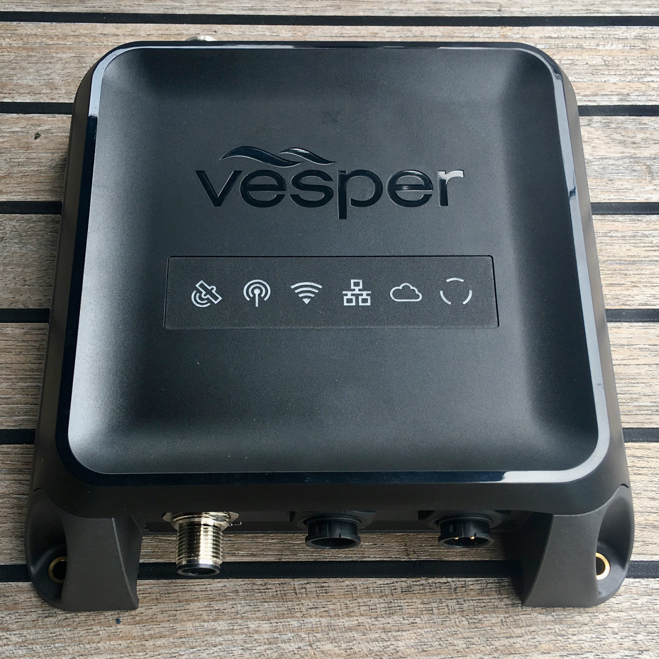
Cortex aboard

We purchased only the Cortex M1 hub which inhibits its use as a VHF radio.  With a handset it becomes a Cortex V1 with fully functional VHF DSC radio in addition to the M1's AIS and a lot more.  The hub includes a connection to an external VHF and an internal splitter - very nice.

Our configuration (core unit only) gives us:

  • Class B+ (5W SOTDMA) AIS
  • NMEA2000 and NMEA0183 gateways
  • GPS/Galileo/Glonass/Beidou-capable high-speed GPS
  • WiFi hotspot
  • Mobile SIM for automated vessel monitor messaging to the Vesper 'cloud'
  • Speaker and loudhailer outputs (alarms plus monitoring of VHF ch 16)
  • CortexOnboard app for our phones & tablets

It took about a week for the package to arrive from the US, mainly because it was stuck in Puerto Rico over a weekend.  It was then in Curacao customs for a week while they processed our duty-free Yacht In Transit papers.

It's aboard!

Out of the box

Removing the XB-8000 then installing and initial cabling of the Cortex was straight-forward but took half a day.  We initially didn't mount the GPS antenna since we knew that wouldn't be fun.  With power applied we connected from an iPhone running the CortexOnboard app.

Connected to WiFi
  
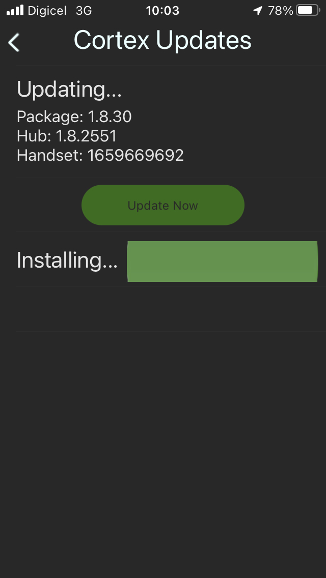
The next step was to update the software.  We did this using our Digicel mobile data.  All went fine.


On checking overall status we discovered the MMSI was not configured.  We had understood from the supplier defender.com that it was configured prior to shipment.  Contacting their excellent support folks exposed that this means they added our boat details (MMSI etc) to the Vesper 'cloud' and the unit should download and install it automatically.  Except we weren't in the US and the mobile interface said it had no signal.  Oops.


Our next step was to RTFM and realise that the unit could access the internet via our onboard network.  So Starlink was turned on and that got us onto the 'cloud' with a US IP address.  But the MMSI remained unconfigured.  So we asked defender.com to provide a programming file for us to apply.  Happily they were able to do so and it worked.  Phew!


Up and running

With the GPS below decks the GPS signal was poor.  So we set about mounting the antenna on the goalpost and running its coax through the s/s tubes into the boat and forward to the navstation.  That was another half day of sweaty work.  But it improved things substantially of course...


With everything up and running we could see vessels up to 30nm away and marinetraffic.com could see us.  Yay!

Cortex provides a number of other display pages on the app.  These include instruments, anchor watch and man overboard.  These will be very useful.  The unit can even be setup to assign crew names to each AIS MOB device.


Of course there are the usual AIS displays - a 'radar' and a list of targets.


And our chartplotters OpenCPN (on our Macs) and Navionics (on our iPhones and iPads) can use the WiFi hotspot to connect to the Cortex's WiFi datastream.  Not all of our NMEA2000 data can be transported over this NMEA0183-based WiFi datastream.  If we want the rest we connect to our SignalK WiFi datastream.

Over recent months there have been a lot of changes to our onboard electrical and electronic systems.  The electronics system diagram has shrunk as our capabilities grew.  Gotta love that!  Here's the new system diagram...


We're very pleased with the Vesper Cortex.  And with a handset it'll get even better.