Hi everyone,
Last weekend I presented a talk at the
Cruising Association on Using GoogleEarth Imagery for Marine Navigation. Over 40 people attended and I think the talk was well-received.
After the talk a tutorial session was held so attendees could load imagery in OpenCPN and generate their own imagery. Attendees brought a variety of platforms with them, including Windows PCs, Macbooks, iPads and Android tablets. This made the tutorial quite challenging and brought home the limitations of using the Windows-only program
GE2KAP to produce KAP file images.
Earlier this year a cruising friend mentioned a new web site which allowed the sharing of routes and similar information. I had a look and quite liked what I saw but the site seemed not to offer anything uniquely interesting. Over recent months the site has developed rapidly and now supports web-based interactive creation of satellite imagery. No need to install any software. The site is
VentureFarther.
As of today a total of over 70,000 images have been made by VentureFarther users. Creating imagery is very simple.
1. Go to the
VentureFarther web site.
2. Register and/or login.
3. Use the tool bar go to Navigation & Planning => Satellite Charts.
4. Pan and zoom in the image pane to the area of interest. The red-shaded box shows the area of your chart. For example here's Hurst Castle in the Solent...
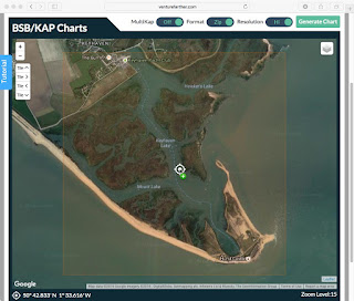 |
| Panned/Zoomed to target area (Hurst Castle in the Solent) |
5. Select the desired options above the image pane:
- MultiKap = On produces a zip file of 9 tiled images of and around the red-shaded area - use the Tile buttons to see each of the tiles in turn
- MultiKap = Off produces a single image
- Format = Zip produces a KAP file (ie not a zip file)
- Format = KAP produces a file which does not appear to be valid
- Resolution = Hi produced a good image
- Resolution = Low produced an image about 1/4 the size of the Hi version
6. Click on Generate Chart.
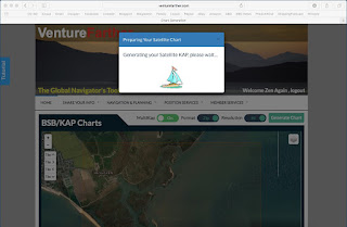 |
| Image creation underway |
7. The file is saved in your Downloads folder. Move the file to the location where your imagery is read by OpenCPN. I keep my UK images in /Users/Shared/charts/ge/Europe/UK. The Windows equivalent would be /Users/Public/charts/ge/Europe/UK.
8. In OpenCPN go to Options => Charts => Chart Files, tick the "Scan Charts and Update Database" check box and click OK. When done zoom/pan to the location of your new image charts and check they're there!
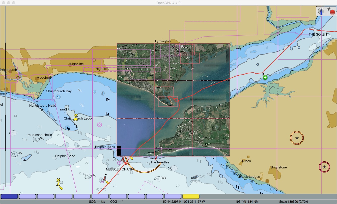
 |
| Tiled images (array of 9 images) loaded in OpenCPN |
9. For use in
SEAiq I suggest combining all imagery for an area in a single zip file. Then download the zip file to SEAiq. When running SEAiq on iPad this is done using iTunes as described in my post
here.
VentureFarther's web-based satellite chart generation is great. It makes satellite imagery-based chart creation easy. I expect to be using it a lot!