Monday 31 October 2016

Autumn in the UK

Hi everyone,
We have now moved ashore and are both working full-time.  We had thought we might live aboard for a year or so but the cost of commuting from Hull to our workplaces made that uneconomic.  It was costing close to 100 pounds each week for petrol alone!

Our "local" - dressed overall for halloween
So we're now living in a small apartment half-way between our workplaces, with reasonable commutes for both of us.  After 18 months aboard the move ashore was a big deal.  We filled our car twice with "stuff" and discovered the boat has better storage than our apartment.  The apartment is considerably warmer however!  And the local pub (above) has great beer and food.

Speaking of warm, that's something Zen Again isn't going to be for quite a while.  We will soon have to "winterise" the boat - something we've never had to do before.  Here's a rough list of what we expect to do:

  • Move stuff ashore to a warmer & drier environment (well underway)
  • Stow loose items staying aboard in sealed containers to prevent rust/mould
  • Empty fresh water tanks and hoses to prevent damage from water freezing
  • Change the engine oil and filter
  • Change the engine fresh water systems' coolant
  • Drain the engine's raw water system and remove the raw water impeller
  • Slacken off the engine's V belt
  • Install a dehumidifier to keep the boat dry and (perhaps) warm

We bought a dehumidifier today after looking for reviews.  Practical Boat Owner recommends the Meaco DD8L Junior.  As it happened there was a unit in stock nearby so we're now testing it at home.

By the way, our next talk at the Cruising Association is now being advertised online here.

Trust all's warm and comfy where you are!

Wednesday 5 October 2016

VentureFarther's Satellite Imagery KAP File Generator

Hi everyone,
Last weekend I presented a talk at the Cruising Association on Using GoogleEarth Imagery for Marine Navigation.  Over 40 people attended and I think the talk was well-received.

After the talk a tutorial session was held so attendees could load imagery in OpenCPN and generate their own imagery.  Attendees brought a variety of platforms with them, including Windows PCs, Macbooks, iPads and Android tablets.  This made the tutorial quite challenging and brought home the limitations of using the Windows-only program GE2KAP to produce KAP file images.

Earlier this year a cruising friend mentioned a new web site which allowed the sharing of routes and similar information.  I had a look and quite liked what I saw but the site seemed not to offer anything uniquely interesting.  Over recent months the site has developed rapidly and now supports web-based interactive creation of satellite imagery.  No need to install any software.  The site is VentureFarther.

As of today a total of over 70,000 images have been made by VentureFarther users.  Creating imagery is very simple.

1.  Go to the VentureFarther web site.

2. Register and/or login.

3. Use the tool bar go to Navigation & Planning => Satellite Charts.

4. Pan and zoom in the image pane to the area of interest.  The red-shaded box shows the area of your chart.  For example here's Hurst Castle in the Solent...

Panned/Zoomed to target area (Hurst Castle in the Solent)
5.  Select the desired options above the image pane:

  • MultiKap = On produces a zip file of 9 tiled images of and around the red-shaded area - use the Tile buttons to see each of the tiles in turn
  • MultiKap = Off produces a single image
  • Format = Zip produces a KAP file (ie not a zip file)
  • Format = KAP produces a file which does not appear to be valid
  • Resolution = Hi produced a good image
  • Resolution = Low produced an image about 1/4 the size of the Hi version

6.  Click on Generate Chart.

Image creation underway
 7.  The file is saved in your Downloads folder.  Move the file to the location where your imagery is read by OpenCPN.  I keep my UK images in /Users/Shared/charts/ge/Europe/UK.  The Windows equivalent would be /Users/Public/charts/ge/Europe/UK.

8.  In OpenCPN go to Options => Charts => Chart Files, tick the "Scan Charts and Update Database" check box and click OK.  When done zoom/pan to the location of your new image charts and check they're there!

Tiled images (array of 9 images) loaded in OpenCPN
9.  For use in SEAiq I suggest combining all imagery for an area in a single zip file.  Then download the zip file to SEAiq.  When running SEAiq on iPad this is done using iTunes as described in my post here.

VentureFarther's web-based satellite chart generation is great.  It makes satellite imagery-based chart creation easy.  I expect to be using it a lot!

Wednesday 21 September 2016

Summer in the UK

Hi everyone,
We've been here in Hull for over a month.  It's been a lot of fun.  The weather has been very good for most of that period with it only starting to cool down over the last few days.

Zen Again in Hull Marina
We've done a few bits and pieces of work on the boat including:

  • End-for-ended the anchor chain
  • Stowed away the mainsail, headsail and staysail
  • Fitted a replacement gas detector sensor
  • Fitted a replacement raw-water temperature sensor to the engine
  • Scrubbed the bottom (as far as we can reach in the dinghy)

While end-for-ending the anchor chain I discovered one of the pins on the swivel which fits between chain and anchor was badly corroded.  There was very little holding the pin in place.

The raw water temperature alarm had been misbehaving since Bermuda where it forced us to take a tow into harbour.  In the Azores the alarm was going off more often and we ignored it while keeping a close eye on the fresh water temperature (for which we have a gauge).  By the time we arrived in the UK the alarm was on continuously - even with the engine cold.  So it is now nice to run the engine without having to find inventive ways to muffle the alarm!

Most of our time here has been spent either at work (Mike) or looking for work (Nicki).  At the moment it looks like Nicki has found a job too - just waiting for final confirmation.

We've been using AirBnB to try out different localities in the Sheffield area.  We spent a week in Chesterfield south of Sheffield and a week in Wickersley north-east of Sheffield.  One was an apartment and the other a two up two down terrace home.

Chesterfield is famous for its crooked church spire
A week after I started work we collected our car.  We bought it from our friends Anne and Graham of sv Kakadu.  It is a Chevrolet Lacetti - famous only as Top Gear's "star in a reasonably priced car" vehicle.  Drive's great!

Our Chevrolet Lacetti
We spent last weekend touring the Peak District with my parents who are on holiday in the UK for my father's 80th birthday.  Tis a very scenic area and we had a great weekend.

Stream in Snake Pass
The tombstone of Little John in the churchyard at Hathersage

Riverside in Bakewell
Bakewell - home of the tart and the pudding!
Rural scene in the Peak District
The "garden" of our rented cottage
Tombsone of an old soldier in Longnor - what an amazing life! 
Another rural scene
Juvenile tawny owl at The Devonshire Arms in Hartington
We'll be driving down to Kent for my father's 80th birthday party this weekend.  On the following weekend (1st October) we'll be training down to London so I can give a talk at the Cruising Association on "GoogleEarth Imagery for Marine Navigation".

Sunday 7 August 2016

Humber Estuary to Hull

Hi everyone,
Yesterday morning at the top of the tide we moved from our anchorage outside the mouth of the Humber estuary to a better anchorage just inside the mouth.  In the early evening we caught the flood up river to Hull Marina.

Zen Again tracks
The 6nm morning passage took a little over an hour.  Getting the anchor up was hard work.  It turns out we weren't anchored in shingle but in rocks.  The anchor had a large rock wedged inside its "roll bar"!

The anchorage just west of Spurn Point was much better.  Pity the tide and wind stopped us getting there on Thursday afternoon.  We put about 8nm on the log while anchored there yesterday as the tidal current of up to 2.5 knots flowed past.  Lots of small overfalls all around.

Spurn Point
View across the Humber from our anchorage - a wide river!
At 1630 (about an hour after low water) we weighed anchor and motored up river.  We had an average of 2 knots of current with us for the 20nm passage which took 3 hours.  There was plenty of commercial traffic including tankers, general cargo ships and passenger ferries.

Passenger ferry passing by
We called Hull Marina when 15 minutes away and the lock keeper had the lock entrance open for us when we arrived.  The lock has vertical cables to which the boat is secured while the lock operates.

The lock opens!
We moored overnight at the waiting dock just inside the lock.  It was great to have arrived at our boat's new home.

Zen Again alongside the Hull Marina waiting dock
This morning we moved the boat to her new pen.  The pens are good with long (albeit quite thin) finger jetties.  There are no cleats.  Instead metal hoops are provided which work just fine.

Zen Again in her new home
Another view
The marina is right in the heart of Kingston-upon-Hull.  The city has been selected as UK City of Culture 2017 and there is a lot of work going on in preparation.  We went for a quick walk around this morning and it seems a very nice little city.  Lots of nice looking pubs and cafes.  Many old buildings but many new ones too.  Hull was the most extensively damaged UK city in WW2 with 95% of buildings damaged.

The main church in the centre of town dates from the 1300s and has a magnificent tower.  It is the largest in England - all those larger are actually cathedrals.  Apparently the church will be promoted to cathedral status as part of the City of Culture events.

The weather has been spectacular today with barely a cloud in the sky.  We spent much of the afternoon cleaning and tidying up the boat.  The river side area of the city adjacent to the marina is staging a live music festival today featuring 30 local bands.  Lots of people about and a great atmosphere.

Thursday 4 August 2016

Orwell River to the Humber Estuary

Hi everyone,
Early yesterday morning we departed Pin Mill on the Orwell.  Our goal was to sail to Hull Marina which is about 20nm up the Humber.  In the event we anchored close offshore at the mouth of the Humber since we missed the tide.  Tides on the Humber are fierce with up to 7m of range and flows of up to 4 knots!

Here are the passage plots...

Zen Again track
Zen Again speed
And here are the vital statistics...
  • Distances/Speeds
    • Route Distance = 150nm
    • Logged Distance = 175nm
    • GPS Distance = 153nm
    • Duration = 30 hours
    • Average boat speed = 5.8kt
    • Average ground speed = 5.1kt
  • Weather
    • Minimum wind speed = 10 kt
    • Average wind speed = 25 kt
    • Maximum wind speed = 30 kt
    • Apparent wind angle range = 0 to 180
    • Seas up to 1.5m
    • Overcast initially but cleared up gradually
  • Engine
    • Total = 4.3 hours
    • Driving = 4.3 hours
    • Charging = 0 hours
The passage was hard work.  For those in WA it was not unlike a Geraldton to Fremantle passage - lots of upwind work - but with strong tidal currents thrown in.  The speed plot shows the strength of the tidal currents but not the effect they have on wave shape!

From the Orwell to off Great Yarmouth we were broad reaching and that was pleasant.  Once we turned the corner we were close reaching into 25-30 knots of wind with very ugly seas.  We were down to staysail and double-reefed main for most of the night.  There was heavy traffic, with a ship passing every 15 minutes or so on average.  We weaved our way between the sand/mud banks which litter this part of the English coast.  All in all a very challenging navigational exercise, especially in the strong wind.

Overnight we passed several wind farms and could see many offshore oil installations out to sea.  We were overflown by several helicopters going to and fro from them.  Some of the wind farms cover a very large area and contain scores of wind generators.

As we approached the Humber the wind was down to about 20 knots but was blowing straight out of the mouth of the river.  And the tide was ebbing fast.  We gave it a good hard go but it just wasn't going to happen so we crossed the mouth of the river and anchored on the seaward side of Spurn Point, feeling a little spurned!  We are comfortably anchored at 53 36.9N 000 09.2E in 7m (at low tide) over shingle (we think).

The weather outlook is for winds to decrease overnight and tomorrow.  We plan to stay here overnight and head up the river to Hull Marina on the afternoon flood tide.  Wish us luck!

Tuesday 2 August 2016

Ramsgate to the Orwell River

Hi everyone,
Yesterday we sailed from Ramsgate to Pin Mill on the Orwell River.  The 50nm passage took 10 hours in slowly increasing winds from 5 to 18 knots.  Since arriving the weather has deteriorated with  showers overnight and mizzle (misty light drizzle) all this morning.  The river banks are muddy but have nice woods and green fields beyond - a very pleasant rural scene.

Here are the usual passage plots...

Zen Again track
Zen Again speed
And here are the vital statistics...
  • Distances/Speeds
    • Route Distance = 50nm
    • Logged Distance = 57nm
    • GPS Distance = 53nm
    • Duration = 10.5 hours
    • Average boat speed = 5.4kt
    • Average ground speed = 5.0kt
  • Weather
    • Minimum wind speed = 5 kt
    • Average wind speed = 10 kt
    • Maximum wind speed = 18 kt
    • Apparent wind angle range = 0 to 120
    • Seas up to 0.5m
    • High cloud with a little sunshine
  • Engine
    • Total = 4.5 hours
    • Driving = 4.5 hours
    • Charging = 0 hours
We motor-sailed for an hour or so after departing Ramsgate due to the light winds.  As the chart above shows the Thames Estuary is full of mud banks.  It is also very tidal with 3m tides and tidal currents over 2 knots.  We timed our passage to catch the ebb.  As a result we were often heading NNW and tracking NNE.

We sailed between Thanet and London Array wind farms - both of which are quite extensive.  Yachts can sail through operational wind farms but the idea didn't appeal, particularly in light winds and strong tide!  The London Array is still under construction so both it and the approaches to it are prohibited areas.
Passing the Thanet wind farm
Once past the two wind farms we passed Kentish Knock and Long Sand shoals.  We were able to sail during this period as the wind gradually increased.  We had a great sail NW across to Cork Sand where our route joined the Felixstowe entry channel.  From there the W wind was dead on the nose so we had to motor.

Once into the port and heading north up the Orwell we were able to kill the motor and sail quietly up the river.

Passing Felixstowe container port
Sailing up the Orwell, passing Suffolk Yacht Haven
We initially anchored directly off Pin Mill which is an interesting looking place.  There are several Thames barges alongside in tidal berths.  In the river there are lots of yacht moorings.  These forced us to anchor on the edge of the channel.  We hurriedly moved downriver to a gap in the moorings when we saw a large cargo ship coming up river!

We expect to stay here for a second night before continuing our passage north.

Wednesday 27 July 2016

Keyhaven to Ramsgate

Hi everyone,
We arrived in Ramsgate at 1800 this evening after a 29 hour passage from Keyhaven.  We had great weather - sunny with only occasional high cloud.  The passage took us nearly half way towards Zen Again's new home.

Here are the usual plots...

Zen Again track
Zen Again speed
Once again the speed plot shows the effect of tide, and also the effect of the wind dropping out and the engine coming on.  We had a lovely sail through the Solent from west to east, carrying the tide with us as far as Cowes and then working through adverse tide for 6 hours.  From Selsey Bill to Dungeness we had the tide with us and from there to Dover it was against us again.  From Dover the tide was with us once more and hurried us home.

Here are the vital statistics...
  • Distances/Speeds
    • Route Distance = 150nm
    • Logged Distance = 157nm
    • GPS Distance = 143nm
    • Duration = 29 hours
    • Average boat speed = 5.4kt
    • Average ground speed = 4.9kt
  • Weather
    • Minimum wind speed = 2 kt
    • Average wind speed = 10 kt
    • Maximum wind speed = 20 kt
    • Apparent wind angle range = 90 to 180
    • Seas up to 1.5m
    • Sunny with some high cloud
  • Engine
    • Total = 9 hours
    • Driving = 9 hours
    • Charging = 0 hours

We spent much of last week travelling around the country to attend interviews and visit family.  Amazingly the first interview yielded a job, so suddenly we needed to get the boat moving towards its new home.  We got back to Keyhaven on Sunday and set to preparing the boat for departure.

Hurst Castle from the mooring on Sunday evening 
Keelboats can only enter and leave Keyhaven close to high tide so we could not depart until the early afternoon.  By the time we got out there was only a couple of hours of easterly current but that hurried us along past Cowes.  It was great sailing down the Solent with yachts, ferries and big ships passing by.

Passing Cowes
We sailed east through Spithead and past the row of old forts which protected the eastern entrance to the Solent.  The tide was against us here, which gave us more time to admire the view.

No Man's Land fort in Spithead
The nice SW wind gradually veered to the NW overnight.  For a while it looked like we'd have to motor but the NW land breeze came in and we had a very pleasant sail overnight.  By 0600 the land breeze had died and our boat speed was down to 3 knots.  The engine went on and stayed on until 1430 when we were approaching Dover.  Happily we didn't need to dodge any of the ferries.

Passing Dover
The last leg from Dover to Ramsgate was very nice with help from the tide and nice flat water.  The last 1/2 mile was interesting with a 2 knot tidal current across the harbour entrance.

In a pen at Ramsgate Marina
We expect to stay here in Ramsgate for up to a week, spending a few days away visiting relatives in Kent.  After that we'll be heading north.

Sunday 17 July 2016

Keyhaven - Week 1

Hi everyone,
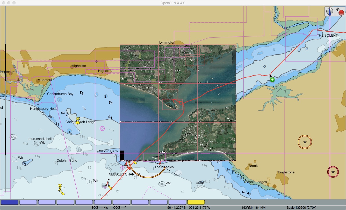
We've now been on a mooring in the Keyhaven River for nearly a week.  It's a great place and the moorings may be the cheapest in the Solent.  Entry for keelboats is limited depending on draft and the river is mostly quite shallow.  We're using a stern anchor to keep us in deep water.  We expect to remain here for several more weeks.

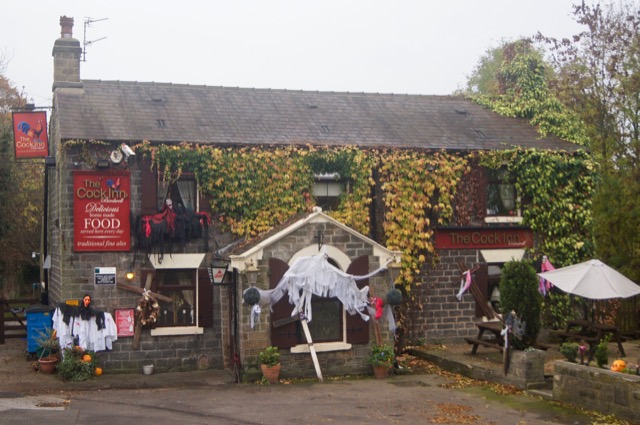
It's a ten minute dinghy trip from our mooring to the small village of Keyhaven.  It is so small there's only one pub - The Gun - but it is a very nice pub indeed.  There are two very active yacht clubs - Keyhaven Yacht Club and Hurst Castle Sailing Club.  The former has an immaculate new clubhouse and visiting yachties are welcome.  Hot showers (free) and warm beer (not).  Honesty box tea, coffee and biscuits.  Most civilised!

Keyhaven River
One of many lovely boats on Keyhaven River
Sun descending over the Keyhaven River
Last Sunday our OCC friends John and Chris, who live nearby, showed us around the area by car.  We visited the closest town Milford on Sea and also the bigger town of Lymington.  They also treated us to a home-cooked dinner which was very nice indeed.  It's great to have OCC contacts around the world!

We've spent a lot of our time job hunting.  Plenty of jobs advertised and Brexit doesn't seem to have slowed them down.  We've had several phone interviews and will attend a couple of on-site interviews next week.

When not job hunting we've been removing several items of surplus equipment to prepare them for sale.  The Aries vane gear, Iridium GO! and Icom HF/SSB are listed on eBay.  We're sad to be selling the Aries but it needs refurbishing which isn't practical aboard.  Less attached to the electronics kit which is best sold while still current equipment.   We'll replace them with the latest kit before going blue water cruising again.

We've been exploring the local area too.  On Wednesday we walked to Lymington along the coast, past the ancient salterns where salt was harvested until the 1800s.  Lots of birds including swans, geese, oyster catchers, coots and of course ducks.  In Lymington we visited the local rigger to see how much it will cost to replace our standing rigging.  We also talked to a marine gas fitter about fitting a heater.  We walked back along the more direct inland paths which was also very nice.

XOD class keelboats racing on the Solent
Country Lane
Country Pub
On Thursday we dinghied over to Hurst Castle and toured the site.  The original castle was built by Henry VIII and it was manned continuously from the mid 1500s to the 1950s.  The Victorians expanded it substantially, installing the same type of muzzle-loading rifled cannon we saw in Bermuda.  During WW2 it had lots of anti-aircraft guns but they were never fired since they didn't want the enemy to know the castle was still manned!

Hurst Castle
Hurst Castle
Original castle entrance surrounded by Victorian brickwork
Victorian big gun
Zen Again (right) from Hurst Castle
Hurst Shingle Bank
One of the exhibits in the castle described local WW2 history, much of which was about the D Day landings.  We were amazed to find a model of the corvette HMS Bluebell which apparently escorted the invasion fleet.  I believe the late Max Shean (an ex FSC Cruising Captain whose S&S 34 was called Bluebell) served on this ship early in the war before volunteering and serving in X craft (midget submarines).

Model of HMS Bluebell at Hurst Castle
While walking along the huge shingle bank which extends from the mainland to the castle we were treated to a one-aircraft air show.  A P51 Mustang did very low-level aerobatics between the Needles and the castle.  Nobody knew why but it was a great show!

Impromptu air show by P51 Mustang
 Trust all's well where you are.