Last weekend I presented a talk at the Cruising Association on Using GoogleEarth Imagery for Marine Navigation. Over 40 people attended and I think the talk was well-received.
After the talk a tutorial session was held so attendees could load imagery in OpenCPN and generate their own imagery. Attendees brought a variety of platforms with them, including Windows PCs, Macbooks, iPads and Android tablets. This made the tutorial quite challenging and brought home the limitations of using the Windows-only program GE2KAP to produce KAP file images.
Earlier this year a cruising friend mentioned a new web site which allowed the sharing of routes and similar information. I had a look and quite liked what I saw but the site seemed not to offer anything uniquely interesting. Over recent months the site has developed rapidly and now supports web-based interactive creation of satellite imagery. No need to install any software. The site is VentureFarther.
As of today a total of over 70,000 images have been made by VentureFarther users. Creating imagery is very simple.
1. Go to the VentureFarther web site.
2. Register and/or login.
3. Use the tool bar go to Navigation & Planning => Satellite Charts.
4. Pan and zoom in the image pane to the area of interest. The red-shaded box shows the area of your chart. For example here's Hurst Castle in the Solent...
 |
| Panned/Zoomed to target area (Hurst Castle in the Solent) |
- MultiKap = On produces a zip file of 9 tiled images of and around the red-shaded area - use the Tile buttons to see each of the tiles in turn
- MultiKap = Off produces a single image
- Format = Zip produces a KAP file (ie not a zip file)
- Format = KAP produces a file which does not appear to be valid
- Resolution = Hi produced a good image
- Resolution = Low produced an image about 1/4 the size of the Hi version
6. Click on Generate Chart.
 |
| Image creation underway |
8. In OpenCPN go to Options => Charts => Chart Files, tick the "Scan Charts and Update Database" check box and click OK. When done zoom/pan to the location of your new image charts and check they're there!
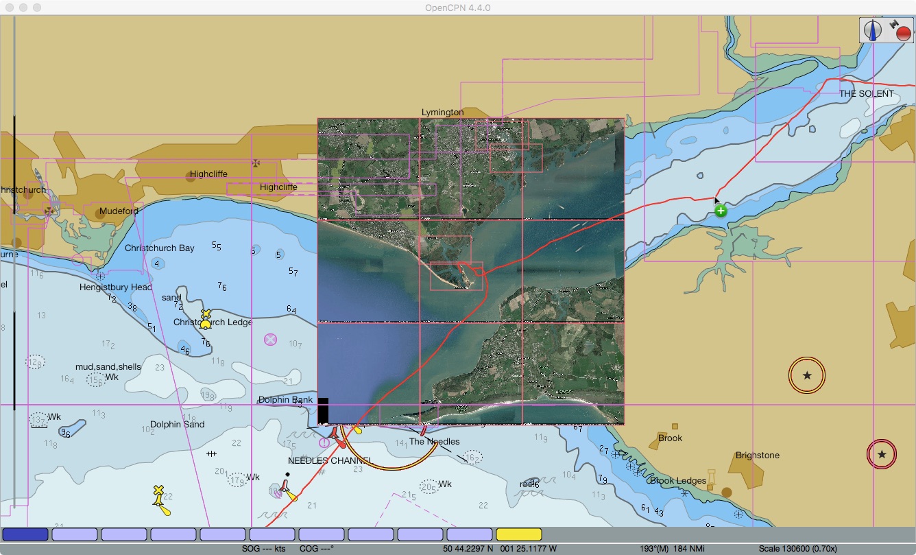 |
| Tiled images (array of 9 images) loaded in OpenCPN |
VentureFarther's web-based satellite chart generation is great. It makes satellite imagery-based chart creation easy. I expect to be using it a lot!
Hi, Jon from VentureFarther here. Thanks for this post. I have been developing this site for almost 4 years now. I generally program a couple hours a day. The site is maturing and I hope as I continue it will keep getting better. Any thoughts or suggestions just let me know.
ReplyDeleteOh, one other thing to mention. SEAiq is directly integrated with VentureFarther. Once configured (directions on the SEAiq website) just double tap the chart and a KAP is created and downloaded.
ReplyDelete