Showing posts sorted by date for query kap. Sort by relevance Show all posts

Thursday, 26 February 2026

Australian, New Zealand and SouthWest Pacific Anchorages

Hi everyone,
This is a technical post.  It follows on from previous posts on Western Australian and New Zealand anchorages.  We've now compiled additional anchorage, mooring and marina waypoints to cover Australia, New Zealand, Fiji, Vanuatu and New Caledonia.

Overview of waypoints in OpenCPN

The new waypoints were compiled from Terry's Topics GPX files and our own research.  Terry's appear to have been provided mainly by SVs Banyandah, Black Duck, Matilda, Olena and SuAn.  Many thanks to them!  We removed most of the many duplicates in Terry's files.  Useful comments and links were retained.  The MinScale parameter was set on most waypoints to avoid obscuring underlying charts - so zoom in to find them all.  And the symbols used were modified to follow our convention.

Our waypoints are also available as KMZ files for GoogleEarth.  The latter are useful for exploring anchorages and marinas in the Google Earth Pro app.  This is especially helpful if you don't have satellite 'charts' installed in OpenCPN.  This of course presumes you have Starlink aboard since Google Earth Pro needs a high-speed internet connection.

With correct setup Google Earth Pro can show your current location via a serial NMEA013 data feed from your boat network.

Our Australian waypoints from Cocos-Keeling to Norfolk Island

Our SouthWest Pacific waypoints for Fiji, Vanuatu & New Caledonia

The screenshot below shows how we arrange our OpenCPN persistent layers.  Each is read from one of our GPX files.  The number of waypoints in each file is shown.  Loading the GPX files as layers avoids inadvertent moving/editing of waypoints.


In addition to our GPX and KML libraries we also have a KAP library.  The KAP library contains satellite 'charts' for use in OpenCPN.

Here are links to the three folders holding this data on our Dropbox site:
None of this information is for use in navigation!

If you find these waypoints useful consider donating using the button at the top of this page.
Alternately Buy us a Coffee!

Trust all's well where you are.

Tuesday, 20 January 2026

Western Australian Anchorages

Hi everyone,
This is a technical post!  It describes a set of 450+ waypoints extracted from the Western Australian Cruising Guide (WACG).  The image below shows the anchorage locations overall.  The WACG covers WA with lesser coverage of western NT and western SA.  It is the WA cruising 'bible'.

Overall Coverage

The WACG is freely available to download here in either ePub or PDF formats.  It has been published by the Cruising Section of Fremantle Sailing Club since 1997.  I have compiled the waypoints from the v5.5 2025 edition.

This set of waypoints is not intended to be a 100% WACG set but I believe it covers 95% or more.  Some waypoints described as 'desperation' anchorages are deliberately omitted.  Likewise some public moorings shown on charts.

WACG Front Cover

As for our New Zealand waypoints, three sets of data are present.  First three GPX files of waypoints (NT, WA & SA) created in OpenCPN.  The waypoints include anchorages, moorings and marinas.  Second a single zip file of KAP satcharts for most of the waypoints.  Third a single KMZ file for use in GoogleEarth.

Below are three GoogleEarth screenshots showing the Kimberley, Pilbara and West/South coast waypoints...

Kimberley

Pilbara

West & South Coasts

Every waypoint includes the WACG v5.5 PDF page number in its description field.  The ScaleMin parameter is set on most GPX waypoints.  This prevents dense sets of waypoints obscuring the underlying charts.  Zoom in to areas of interest to see all waypoints.  The screenshots above show all waypoints.

The accuracy of these waypoints has NOT been verified.
NOT for use in navigation!

The GPX files may be downloaded here.
The three files are named "ZenAgain_Waypoints_Australia_??.gpx".
Each file should be added to OpenCPN as a 'layer'.

The KAP zip file may be downloaded here.
The file is named "Australasia_Australia.zip".
Unzip the file then place the files in a folder searched by OpenCPN for charts.

The KMZ file may be downloaded here.
The file is named "ZenAgain_Waypoints_WACG.kmz".
Load the file in either the Google Earth Pro app or its online equivalent.

Here is a short video tour of WACG waypoints - from Darwin to Port Lincoln via Broome, Exmouth, Fremantle, Augusta and Esperance...


If you find these waypoints useful consider donating using the button at the top of this page.
Alternately Buy us a Coffee!

Trust all's well where you are.

Monday, 22 December 2025

New Zealand GoogleEarth KML File

Hi everyone,
This is a technical post.   It follows posts on a set of New Zealand OpenCPN waypoints and another on an associated set of KAP 'charts'.  Here we put the waypoints in GoogleEarth itself, providing another means of visualising the places and their surroundings.

Overview

Here are links to the preceding posts:
Here are links to the three folders holding this data on our Dropbox site:
None of this information is for use in navigation!

To use GoogleEarth you can either install the Google Earth Pro app or run Google Earth in your browser.  In either you can load our KMZ file.  Then you can explore the ~550 anchorages, moorings and marinas in our set.

The screenshots below show the waypoints in various popular cruising areas.

Northland

Hauraki Gulf

Abel Tasman and Marlborough Sound

Fiordland

Stewart Island

The GoogleEarth Tour below gives an idea of the detail available, moving from Three Kings Islands in the north to Stewart Island's Port Pegasus in the south via Opua, Auckland, Nelson, Milford Sound and Preservation Inlet.


If you find our KML library useful consider donating using the button at the top of this page.  Alternately Buy Us A Coffee.

Trust all's well where you are!

Wednesday, 17 December 2025

New Zealand GoogleEarth KAP Charts

Hi everyone,

This is another technical post.  Last week I created a set of about 400 New Zealand anchorage, mooring and marina waypoints, primarily for use in OpenCPN.  They're publicly available and described here.  This week's task was to create GoogleEarth KAP satellite image 'charts' for them all.  KAP charts can be displayed in OpenCPN.

Viewing Zen Again's location in OpenCPN using KAP charts

Many sailors using satellite imagery in OpenCPN have abandoned KAP charts in favour of MBTILES charts.  The latter allow one to zoom in and out, viewing varying levels of detail while doing so.  I prefer to only use satellite imagery when zoomed in on a small area, for example a narrow pass or a small bay.  KAP files are also much smaller, for example MBTILES for all New Zealand is about 6GB while my KAP files are about 400MB.  Both formats have their uses.

Read this post to learn about our KAP library and how to use satellite imagery.

The KAP library is on Dropbox here and the file is Australasia_NewZealand.zip.

The quality of satellite imagery varies enormously - regardless of format.  Below are a series of KAP charts in OpenCPN.  They range from very clear to 'clear as mud'.  Many of the Fiordland images are very dark due to poor light in the fiords - they're surrounded by tall mountains after all!

Napier Harbour

Sailor's Rest on Stewart Island

Kelly's in Fiordland

Alice Falls in Fiordland - note the water course

Harrison Cove in Fiordland

If you look carefully at the image below you'll see lots of small red 'dots'.  They're actually rectangles showing the location of each chart.  The set includes all main cruising areas, but of course no set is exhaustive.


All of these KAP charts were created using the VFKaps OpenCPN plugin.  This fantastic tool makes the process very easy.  The 'VF" in VFKaps refers to VentureFarther, a web site setup to assist cruisers.  To create KAP files using the plugin you need to pay a US$20 subscription to VentureFarther.  This buys you the API key required by the plugin.  Worth every cent!

If you find our KAP file library useful consider donating using the button at the top of this page.  Alternately Buy Us A Coffee.

Trust all's well where you are!


Tuesday, 19 April 2022

GoogleEarth KAP Library Update 2

Hi everyone,

It has only been a few months since we updated our KAP Library of GoogleEarth images.  The library provides satellite images translated into 'charts', primarily for use in OpenCPN and SEAiq.  The library is publicly accessible on Dropbox.

The library and its use are described here.

The full set of blog posts relating to the KAP library is here.

Additions mostly to West Caribbean

The additions and updates to the library include KAP files in the following countries:

  • Caribbean
    • ABCs
    • AntiguaBarbuda
    • Belize
    • CaymanIslands
    • Columbia
    • CostaRica
    • Cuba
    • DominicanRepublic
    • Guadeloupe
    • Guatamala
    • Honduras
    • Jamaica
    • Mexico
    • Nicaragua
    • Panama
    • StMartin
    • Venezuela

There are about 900 new 'charts'.  The largest of the files is less than 160MB in size.

Here are some screenshots from OpenCPN showing the coverage in some of the countries...

ABCs

Belize

Cayman Islands

Columbia

Dominican Republic

Guatemala (Rio Dulce)

Honduras (Bay Islands)

Jamaica

Panama (Bocas del Toro & San Blas)

The new files were created using VentureFarther's OpenCPN plugin 'vfkaps'.  The plugin makes it easy to create new KAP files.

Your collection of KAP files is welcome in our library.  Get in touch if you can fill some gaps in our coverage!


Thursday, 20 January 2022

Antigua to Barbuda

Hi everyone,
Today we sailed from Deep Bay on Antigua to Cocoa Point on Barbuda.  It was our first close-hauled passage since we approached Gibraltar from Portimao last year.  The boat went well and the crew hung on!

The wind was more NE than the ENE it was supposed to be.  And as expected there was a 1 knot W current, requiring us to head up as high as possible to lay the island.  We sailed under 1 reef and 3 furls which kept things comfortable.

A couple of large yachts came tramping past doing 10 knots.  One of them even tried to climb over us - what a b#E%^$d!!!  But Kazi the WindPilot calmly pinched him out and he ducked below us when only a few boat lengths behind.

Here are the usual graphs…

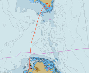
Track

Arrival Track

Graphs

And a few stats…
  * Time = 5h30m
  * Route = 27nm
  * Track = 28nm
  * Log = 28nm
  * Average Boat Speed = 5.1kt
  * Average Ground Speed = 5.1kt

The arrival track image shows a GoogleEarth KAP chart since our marine chart in OpenCPN isn't very accurate.  The Navionics chart on our iPads is better and notes indicate the coast of Barbuda, particularly the west coast, was heavily impacted by Hurricane Irma a few years ago.  We encountered no bombies and had 6m all the way in to the anchorage.  We are anchored in 5m over sand at 17 33.07N 061 46.17W.

In the anchorage there are about a dozen yachts.  Two of them are superyachts.  There are also two massive motoryachts.  Ashore are exclusive resorts and a number of new buildings under construction.

Unexpectedly, there is no mobile phone coverage here at Cocoa Point.  So we're sending this via our Iridium Go!.  Those of you expecting emails from us - please check your Junk/Spam folders for emails from our satphone.me accounts.

Trust all's well where you are.

Friday, 15 October 2021

GoogleEarth KAP Library Update

Hi everyone,

It has been years since we updated our KAP Library of GoogleEarth images.  The library provides satellite images translated into 'charts', primarily for use in OpenCPN and SEAiq.  The library is publicly accessible on Dropbox.

The library and its use are described here.

The full set of blog posts relating to the KAP library is here.

Nearly 4000 new KAP charts

The additions and updates to the library include KAP files in the following countries:

  • Africa
    • Tunisia
  • Caribbean
    • Bahamas
    • Turks & Caicos
  • Europe (limited coverage)
    • Ireland
    • Italy
    • Malta
    • Portugal
    • Spain
  • NorthAtlantic
    • Canaries
    • Madeiras
The image below shows the new files in Dropbox.  The Bahamas zip file is large at 2.6GB - it includes about 3600 KAP files.

New zip files on Dropbox

The new files were created using VentureFarther's OpenCPN plugin 'vfkaps'.  The plugin makes it easy to create new KAP files.

Your collection of KAP files is welcome in our library.  Get in touch if you can fill some gaps in our coverage!


Thursday, 16 January 2020

Winter Maintenance in London Year2 #1

Hi everyone,
Another long time no post situation.  Two topics today.

Presentations

Over the years we've been asked to give presentations by various organisations.  We've put the PDF versions of the slides online for reference.  They can be found on Dropbox here.

It's interesting that the most common topic is use of satellite imagery in marine navigation.  Our posts on this topic are amongst the most popular.  These can be found by searching the blog for "kap", the result of which is here.

Perspex

Last year we decided to upgrade our perspex washboards.  Washboards fit in the companionway to either lock up the boat or to keep water out of the cabin at sea.  In the past we've "copped greenies" which cascaded water down into the cabin.  In one incident we flooded the cook top and a gas sensor below it.  With closed washboards that shouldn't happen.

Washboards are often in two pieces so that one can be fitted, allowing crew to clamber over it when going on deck or going below.

We have two-part wooden washboards which have steadily reduced in thickness at each refurbishment.  They're now oiled and look good but are a little thin.  The top half has vents which are good for ventilation in harbour but not good in the face of solid water at sea.

We also had a one-part tinted perspex washboard.  This was quite thin and so not up to the job either.

Late last year we ordered new perspex washboards from Project Plastics.  They are 15mm thick and fit perfectly - measure N times, build once!  They are tinted and in two pieces.  The upper board had a cut-out to transfer an inspection hatch.  We transferred other fittings too, including the latch with which the companionway can be locked.

New washboards
The inspection hatch is interesting.  It's purpose is to allow crew on deck to unlock the two barrel bolts below which secure the sliding companionway hatch cover.  It's a sensible safety rule that companionway locks must be operable from on deck and below.

The increased thickness of the new perspex meant we had to rebuild the s/s latch mechanism.  The photo below shows the "kink" we needed in the s/s bar.  Thanks Dave!

Modified hinge
We still have the canvas cover we installed in Darwin some years ago.  It folds up to rest atop the hatch cover.  It's great for privacy, for keeping the sun off computer screens below and for keeping the rain out in light-moderate following winds.

Canvas cover unchanged
Our winter projects are electronics.  We're currently working on SaiLog, an app to display realtime data from our NMEA-2000 network.  More on that in due course - hopefully soon!

Wednesday, 5 October 2016

VentureFarther's Satellite Imagery KAP File Generator

Hi everyone,
Last weekend I presented a talk at the Cruising Association on Using GoogleEarth Imagery for Marine Navigation.  Over 40 people attended and I think the talk was well-received.

After the talk a tutorial session was held so attendees could load imagery in OpenCPN and generate their own imagery.  Attendees brought a variety of platforms with them, including Windows PCs, Macbooks, iPads and Android tablets.  This made the tutorial quite challenging and brought home the limitations of using the Windows-only program GE2KAP to produce KAP file images.

Earlier this year a cruising friend mentioned a new web site which allowed the sharing of routes and similar information.  I had a look and quite liked what I saw but the site seemed not to offer anything uniquely interesting.  Over recent months the site has developed rapidly and now supports web-based interactive creation of satellite imagery.  No need to install any software.  The site is VentureFarther.

As of today a total of over 70,000 images have been made by VentureFarther users.  Creating imagery is very simple.

1.  Go to the VentureFarther web site.

2. Register and/or login.

3. Use the tool bar go to Navigation & Planning => Satellite Charts.

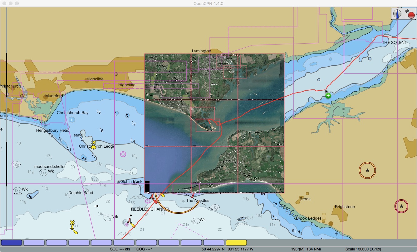
4. Pan and zoom in the image pane to the area of interest.  The red-shaded box shows the area of your chart.  For example here's Hurst Castle in the Solent...

Panned/Zoomed to target area (Hurst Castle in the Solent)
5.  Select the desired options above the image pane:

  • MultiKap = On produces a zip file of 9 tiled images of and around the red-shaded area - use the Tile buttons to see each of the tiles in turn
  • MultiKap = Off produces a single image
  • Format = Zip produces a KAP file (ie not a zip file)
  • Format = KAP produces a file which does not appear to be valid
  • Resolution = Hi produced a good image
  • Resolution = Low produced an image about 1/4 the size of the Hi version

6.  Click on Generate Chart.

Image creation underway
 7.  The file is saved in your Downloads folder.  Move the file to the location where your imagery is read by OpenCPN.  I keep my UK images in /Users/Shared/charts/ge/Europe/UK.  The Windows equivalent would be /Users/Public/charts/ge/Europe/UK.

8.  In OpenCPN go to Options => Charts => Chart Files, tick the "Scan Charts and Update Database" check box and click OK.  When done zoom/pan to the location of your new image charts and check they're there!

Tiled images (array of 9 images) loaded in OpenCPN
9.  For use in SEAiq I suggest combining all imagery for an area in a single zip file.  Then download the zip file to SEAiq.  When running SEAiq on iPad this is done using iTunes as described in my post here.

VentureFarther's web-based satellite chart generation is great.  It makes satellite imagery-based chart creation easy.  I expect to be using it a lot!

Thursday, 11 February 2016

St Helena Inbound Day 10

Hi everyone,
We are currently in position 20 43S 001 44E and saillng at 6 knots on a course of 280M. The wind is SE at 14-16 knots with a 1m sea and 1m SW swell.  We are sailing under full main and single-furled yankee.  Mostly sunny sky.  Our day's run was 137nm and we have 510nm to go.

Yesterday the Ocean Cruising Club announced its 2015 prize recipients.  A few days ago the OCC informed me I was to be awarded the Water Music trophy.  A very nice surprise!  The award is for my creation of a publicly-accessible library of GoogleEarth imagery KAP charts.  These charts are an aid to marine navigation, particularly in the less well charts parts of the world.  The library is described in the post GoogleEarth KAP library for OpenCPN and SEAiq on this blog.

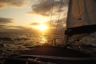
Chasing the sunset yesterday

Yesterday afternoon we had a great sail although under mostly "anticyclonic gloom" clouds.  The wind was 10-15 knots which was enough to keep us moving along.  Overnight the wind picked up to 12-18 knots and we made good progress, missing several rain showers which passed close by.  This morning there's only patchy cloud and the wind is 14-16 knots from the SE - champagne sailing!

This morning I conducted the South Atlantic Crosser's HF net.  Everyone is making good progress and enjoying the conditions.  There are several boats with DSC-equipped HF radios and we are experimenting with Position Reports prior to the net.  I wonder if this is the first such use of DSC routine calling on a cruising net?

A Famous LP

Treatment of the LP recordings I mentioned yesterday is proceeding apace.  One of the LPs is the well-known Telarc recording of Tchaikovsky's 1812 Overture performed by the Cincinnati Symphony Orchestra.  It came with a warning to turn up the weight on the turntable's stylus to avoid it jumping out of the track when the cannons went off.  Happily I recorded the LP to MP3 on my father's marvellous B&O turntable.  It's a great recording and the cannons are spectacular.

Trust all's well where you are.

Thursday, 23 April 2015

GoogleEarth KAP library for OpenCPN and SEAiq

Hi everyone,
For several years I have been creating and swapping GoogleEarth imagery for use in the free chartplotter OpenCPN.  The imagery is captured using GoogleEarth and GE2KAP while online and produces KAP files for use offline in OpenCPN.  Perfect as an extra aid to navigation in poorly charted areas, as described in my 2012 post here.

All the imagery I have created and which I have collected from others is intended to be shared.  I have shared on an individual basis so far.  The data is now available online.

The library is on Dropbox here.

For those who return to the library looking for new or updated information: click on the "Modified" column heading in Dropbox.  This will sort the files by modification date with most recent at the top.

First download and store somewhere safe the file "_readmefirst.txt".  Keep it for offline use.  The contents of the file are below since it provides much of what I need to explain here.  Please read on!

=======================================================================
                               A Guide to using 
                     Zen Again's Dropbox KAP File Library
                        for use with OpenCPN and SEAiq
======================================================================= 

Origin and Further Distribution
-------------------------------
The KAP files in this library have been generated by various cruisers 
including myself.  All who have provided files to me have indicated their 
willingness for me to distribute them further.  The only proviso we make is 
that they be further freely shared to assist other cruisers.

Intended Applications
---------------------
The KAP files have been tested in OpenCPN and SEAiq using the latest versions
available at the above date.

File Naming
-----------
The ZIP files are named in the following formats:
A. <Region>_<Country>_<Locality>.zip or
B. <Australia>_<State>_<Locality>.zip

File Size
---------
The KAP files are split into modest size ZIP files for two reasons:
1. To allow the selection of specific KAPs of interest without having to 
   download large files.
2. To allow for use in SEAiq which (since it runs on tablets) could be 
   slowed dramatically if many hundreds of KAPs are loaded.

Installation
------------
For those with pre-existing OpenCPN chart folders such as:
  MacOSX:  /user/Shared/charts/opencpn/ge/<region> or 
  Windows: /Users/Public/charts/opencpn/ge/<region> where region is Asia, Indian etc
simply add to (or replace) the existing contents with the contents of the 
ZIP files you download here.

For those with pre-existing SEAiq chart ZIP files simply add my zip files 
nearby and use iTunes to add them to (or later delete them from) SEAiq. 

Using KAP Files
---------------
See the following blog posts:
Using GoogleEarth Imagery for Marine Navigation
  http://yachtzenagain.blogspot.com.au/2012/10/using-googleearth-images-for-marine.html

Making KAP Files
  http://yachtzenagain.blogspot.com.au/2012/04/simple-guide-to-installing-and-using.html

GoogleEarth Imagery on iPad
  http://yachtzenagain.blogspot.com.au/2015/04/cm93-charts-and-googleearth-imagery-on.html

GoogleEarth Imagery on Raspberry Pi
  http://yachtzenagain.blogspot.com.au/2014/10/super-cheap-cruising-chartplotter-and.html

Updates
-------
The library will be updated from time to time.  Individual files may be updated 
so check the date stamp of files you use.  New files may be added so check for 
new files in your region of interest.

Additions
---------
If you would like me to add your images to this library just let me know.

Remember!!!
-----------
GoogleEarth images FADE TO BLACK a few hundred metres from land!!!

=======================================================================

Now to add some help for installing charts in OpenCPN and SEAiq.

Installing and Configuring in OpenCPN
  1. Download all the ZIP files of interest from Dropbox - usually to your downloads folder.
  2. Identify where your existing charts are located (Shown in OpenCPN in Options => Charts => Chart Files.  [I locate my KAP charts in /Users/Public/charts/opencpn/ge on Windows and /Users/Shared/charts/opencpn/ge on Mac OS X]
  3. If they don't already exist, create folders for regions (eg SEAsia, Australia, IndianOcean or similar) in the folder you intend to use for your GE imagery.
  4. Unzip (on Windows use right-mouse-button => Extract To) each of the downloaded ZIP files to the appropriate region folder.  Unzipping will create a folder for the <Locality> described in the readme file above.
  5. Check that your folder structure looks something like "charts/opencpn/ge/Australia/Abrohlos" with .kap files in the Abrohlos folders.
  6. If you wish you can add an extra layer of folders to fully mimic the file naming structure in the readme.  This depends on how you wish to use Chart Groups - read on!
  7. In OpenCPN go to Options => Charts => Chart Files.
  8. You should see a list of chart folders OpenCPN is using, often including a folder "CM93".  If you have some KAP files already loaded then there should be another folder.
  9. Click the Add Directory button, browse to the folder where your new KAP files exist, highlight the folder then click on Open.  I suggest highlighting the region folder (eg Australia, SEAsia etc), not the locality folder (unless you want a Chart Group for each locality).
  10. Tick the "Force Full Database Rebuild" switch and click OK.  OpenCPN will then scan all your chart directories building its chart index database, which may take a minute or three.
  11. When the rebuild finishes, zoom way out (using the "-" key) so you can see the regions covered by your GE imagery.  You should see small red boxes which show the location of each image.  If not go into Options => Display, turn on Show Chart Outlines, click OK and look again.
  12. To view a GE image zoom in over one of the red boxes and centre it in the screen.  At the bottom of the OpenCPN window you should see blue "tabs" appear to the left of the yellow tab which was there before.  The rightmost tab is always the real (vector) chart.  Others are image (raster) charts.  Click on the leftmost tab to open what is usually the best image for the location.
  13. Sometimes OpenCPN zooms when you change from one "tab" to another.  IMHO this is a bug.
Configuring Chart Groups in OpenCPN
  1. Go to Options => Charts => Chart Groups.  In the Chart Groups panel you will see an All Charts tab.  We are going to add more so that the number of GE images OpenCPN is dealing with can be controlled despite them all being installed.  I usually define Chart Groups for a region of the globe (SEAsia, Australia etc).
  2. To create a Chart Group click on New Group and give it a name (for example GEseasia) and click OK.  Then click on your vector charts (often CM93) folder and click Add.  Click on the relevant GE chart folder and click Add.  You may wish to create a Chart Group called CM93only with no GE folders included.
  3. When finished click OK to exit Options.
  4. In OpenCPN zoom way out (using the "-" key) so you can see the regions covered by your GE imagery.  You should see small red boxes which show the location of each image.
  5. Right mouse button, move over to Chart Groups and right into the list of groups.  All Chart Groups is probably ticked.  Click over another group and you should  see a set of red boxes disappear.  Chart Groups are a nice way to manage what images are accessible.  Once familiar with all this you can turn off Show Chart Outlines since drawing them seems to keep OpenCPN quite busy.
Installing and configuring in SEAiq
  1. Download all the ZIP files of interest from Dropbox to the computer you use to sync your iPad - usually to your downloads folder.
  2. Identify where your existing charts are located.  [I locate my KAP charts in /Users/Public/charts/opencpn/zip on Windows and /Users/Shared/charts/opencpn/zip on Mac OS X].
  3. Connect your iPad to the computer and let it sync if it wishes.  Open iTunes if it doesn't open automatically.
  4. Click on the iPad symbol at top left of iTunes, then click on Apps on the left.
  5. Scroll all the way down past the Apps list to the File Sharing list.
  6. Click on SEAiq Open in the File Sharing list on the left.
  7. On the right you now have a SEAiq Open Documents list which may be empty.  At the bottom of the list click on Add.  Browse to the folder containing the downloaded ZIP files.  Select those you wish to install in SEAiq and click Add.  You will see a progress bar at the top of iTunes.
  8. On the iPad open SEAiq and click on Charts at bottom right.  Wait for it - the response can take a few seconds if you downloaded ZIP files containing hundreds of images.
  9. When the Charts page loads you should see a row for each ZIP file, with each showing its size and number of KAP (image) files it contains.
  10. Now you see the logic behind the file naming scheme!
  11. Note that you download CM93 charts in a similar way, just select your CM93 ZIP file in iTunes and Add it to SEAiq.
  12. Click on Navigate and pan/zoom to the locality of the imagery you transferred.  You should see faint orange boxes delimiting the images.
  13. To change between vector (CM93) and raster (KAP image) charts click on the Settings tab and and move the slider on the Raster line in the Charts section, then return to Navigate.  You may need to pan slightly to have the page redraw.  Hey Presto!
  14. ZIP files can be removed from SEAiq in either iTunes or on the iPad directly in the Charts page. 
Hope the above helps you install the imagery.  Let me know if you like it and if you want more.

Here are two screenshots from SEAiq showing Cape Vlamingh on Rottnest Island WA.  Breaks on the reefs are clearly visible.
GE image of Cape Vlamingh, Rottnest Island, WA in SEAiq
Chart (decluttered) of Cape Vlamingh, Rottnest Island, WA in SEAiq